
Europe Map Quiz
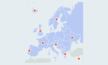
45 countriesSmall places have round markers · Ctrl + scroll to zoomTwo fingers to pan and zoom
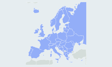
Find every country of Europe on a blank map, microstates included. Play all 45 or one region at a time. Free, no sign-up.
How many countries are in Europe?
This quiz asks 45 countries, the 44 that the UN groups under Europe, Russia and Vatican City included, plus Cyprus, an EU member that the UN places in Western Asia. Counts above 50 add transcontinental countries such as Turkey, Georgia and Azerbaijan, or Kosovo, which is drawn hatched and not asked.
- 45countries asked, Cyprus included
- 4UN regions
- Russialargest by area
- Vatican Citysmallest
The countries of Europe by region
The quiz follows the four regions of the UN geoscheme, with Cyprus played as part of Southern Europe. Each region can be played on its own from the region menu, and after a full round the result names the region you missed most.
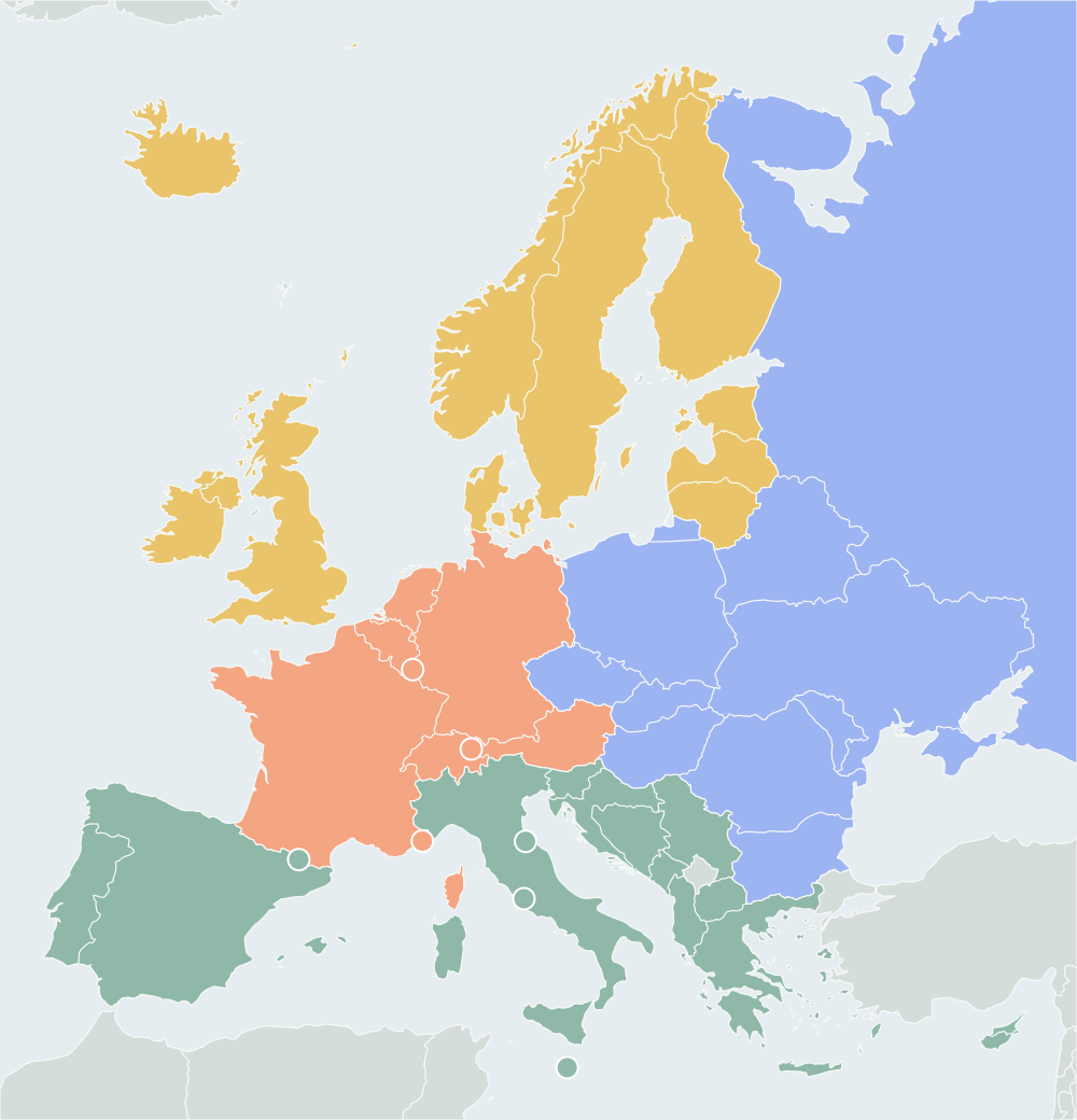
Northern Europe10
Denmark, Estonia, Finland, Iceland, Ireland, Latvia, Lithuania, Norway, Sweden, United Kingdom
Western Europe9
Austria, Belgium, France, Germany, Liechtenstein, Luxembourg, Monaco, Netherlands, Switzerland
Southern Europe16
Albania, Andorra, Bosnia and Herzegovina, Croatia, Cyprus, Greece, Italy, Malta, Montenegro, North Macedonia, Portugal, San Marino, Serbia, Slovenia, Spain, Vatican City
Eastern Europe10
Belarus, Bulgaria, Czechia, Hungary, Moldova, Poland, Romania, Russia, Slovakia, Ukraine
Hardest European countries to find
Most misses are the microstates and the Balkans. The microstates have small rings; zoom in, or tap near one and the quiz takes the nearest small country.
- MicrostatesVatican City, Monaco, San Marino, Liechtenstein, Andorra, Malta, Luxembourg
- The BalkansSlovenia, Croatia, Bosnia and Herzegovina, Serbia, Montenegro, North Macedonia, Albania
Countries people mix up
- Slovakia · Slovenia
- Slovakia lies north of Hungary, between Czechia and Ukraine. Slovenia is the small Alpine country between Italy and Croatia.
- Estonia · Latvia · Lithuania
- The three Baltic states run north to south in alphabetical order. Estonia is at the top, below Finland.
- Netherlands · Belgium · Luxembourg
- The Netherlands is north, on the coast; Belgium is below it, and Luxembourg is the small landlocked one southeast of Belgium.
- Montenegro · North Macedonia · Albania
- Montenegro is on the coast north of Albania; North Macedonia is landlocked, east of Albania.
How to learn the map of Europe
- Start with the anchors: the United Kingdom, France, Spain, Germany, Italy, Poland and Ukraine. Then add their neighbours.
- Play one region at a time from the region menu. The map zooms to that region and greys out the rest.
- Replay only your misses with Practice the ones you missed. When you come back another day, the quiz offers a round of the countries you have not yet mastered.
- Hide the borders for a harder round. You then place each country from the coastline and the countries you have already found.
Other names you may know
The quiz uses short English names. Czechia is also the Czech Republic, North Macedonia was Macedonia, the Netherlands is often called Holland, Vatican City is the Holy See and Bosnia and Herzegovina is often shortened to Bosnia. The United Kingdom includes Great Britain and Northern Ireland.
Questions
Is Turkey in the quiz?
No. A small part of Turkey is in Europe, but the UN places the country in Western Asia, so it is drawn as background here and asked in the Asia and Middle East quizzes.
Why is Russia cut off at the edge of the map?
Russia is asked, but the map stops at the Urals so the rest of Europe can be drawn large. Click the part of Russia you can see.
Is Kosovo asked?
No. Kosovo is not a UN member state, so it is drawn hatched and a click on it does not count as an answer.
Does the quiz work on a phone?
Yes. Tap a country to answer. Use two fingers, or the + and − buttons, to zoom and move the map; one finger scrolls the page. In full screen the map takes every gesture.
Scores stay in this browser. How AtlasWhiz saves your progress